Hurricane Harvey Intensifies to Category 3 Storm
The National Hurricane Center says Hurricane Harvey has intensified into a Category 3 storm ahead of its expected landfall late Friday or early Saturday morning.
Friday, 25 August 2017 16:00:00 -05:00
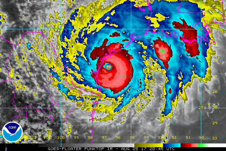
At 4 PM CDT, the National Hurricane Center (NHC) reported that "major hurricane Harvey is bearing down on the Texas coast" as Hurricane Harvey grew into a Category 3 hurricane. A Category 3 hurricane sports winds between 111 and 129 mph, and may cause major damage to even well-built homes including the removal of the roof decking, snapping or uprooting of trees, and damage to electrical power lines or water supplies.
Forecasters had previously stated that they had recorded pressure drops in the eye of the storm indicating that the storm would intensify. Catastrophic flooding is expected due to the forecasted heavy rainfall and storm surge. Weather conditions continue to deteriorate and water levels are rising along the Texas Coast.
The NHC reported that the eye of Hurricane Harvey was located near latitude 27.4 North, longitude 96.4 West, about 70 miles east southeast of Corpus Christi, Texas. The storm is moving northwest at about 10 mph but is expected to slow as it approaches landfall.
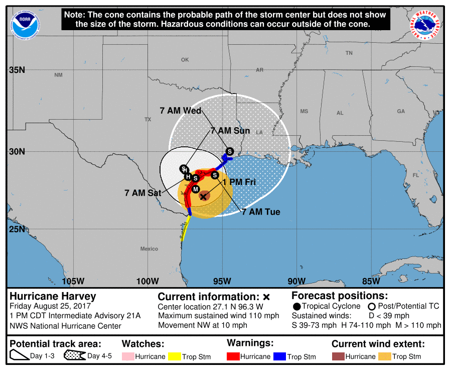
The effects of the storm are already being felt inland with the Corpus Christi Naval Air Station recently reporting sustained winds of 53 mph (85 km/h) with gusts up to 64 mph (104 km/h). Landfall is expected late Friday evening or early Saturday morning.
ContactRelief's recommendation to suspend contact with consumers in the affected areas was issued Thursday, August 24 at 10:16 am CDT and continues to remain in effect until further notice.
Protect your brand AND revenue when disaster strikes.
Try ContactRelief FREE for 30 days. Discover how we can help you reach up to 5x more customers in a disaster zone – while protecting your brand image.
Start free trial