Pacific Tropical Storm Erick Strengthens While Tropical Storm Flossie Forms
Erick expected to reach Hurricane status very soon, Flossie by Tuesday
Monday, 29 July 2019 12:20:18 +00:00
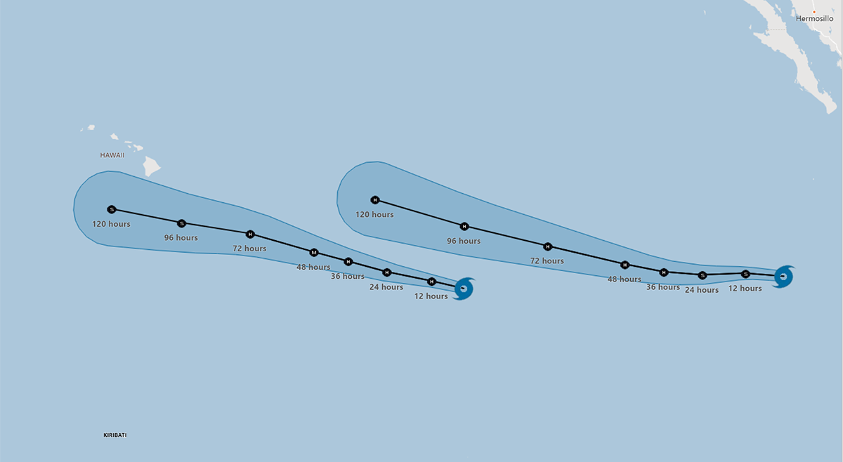
Tropical Storm Erick Update
Eastern Pacific Tropical Storm Erick is on a course to pass south of Hawaii late this week. Forecasters at the National Hurricane Center expect the storm to intensify into a Hurricane today and a Category 3 hurricane on Tuesday.
At 1100 PM HST (0900 UTC), the center of Tropical Storm Erick was located near latitude 11.7 North, longitude 134.5 West. Erick is moving toward the west near 16 mph (26 km/h), and this motion is expected to continue through Monday. A turn to the west-northwest and a slower forward speed is expected to start on Tuesday and continue through Wednesday.
Maximum sustained winds have increased to near 70 mph (110 km/h) with higher gusts. Rapid strengthening is forecast during the next 48 hours, with Erick likely becoming a hurricane on Monday, and potentially a major hurricane on Tuesday. A weakening trend is forecast to begin by late Wednesday. Tropical-storm-force winds extend outward up to 70 miles (110 km) from the center. The estimated minimum central pressure is 995 mb (29.39 inches).
Tropical Storm Flossie Update
Tropical Storm Floosie, shown below, has formed off the Mexican coast and may reach hurricane strength as early as Tuesday.
At 1100 PM HST (0900 UTC), the center of Tropical Storm Flossie was located near latitude 12.5 North, longitude 113.0 West. Flossie is moving toward the west near 20 mph (31 km/h) and this general motion is expected to continue for the next few days with a slight decrease in forward speed.
Maximum sustained winds are near 40 mph (65 km/h) with higher gusts. Gradual strengthening is expected, and Flossie is expected to become a hurricane on Tuesday or Tuesday night. Tropical-storm-force winds extend outward up to 80 miles (130 km) from the center.
The estimated minimum central pressure is 1005 mb (29.68 inches).
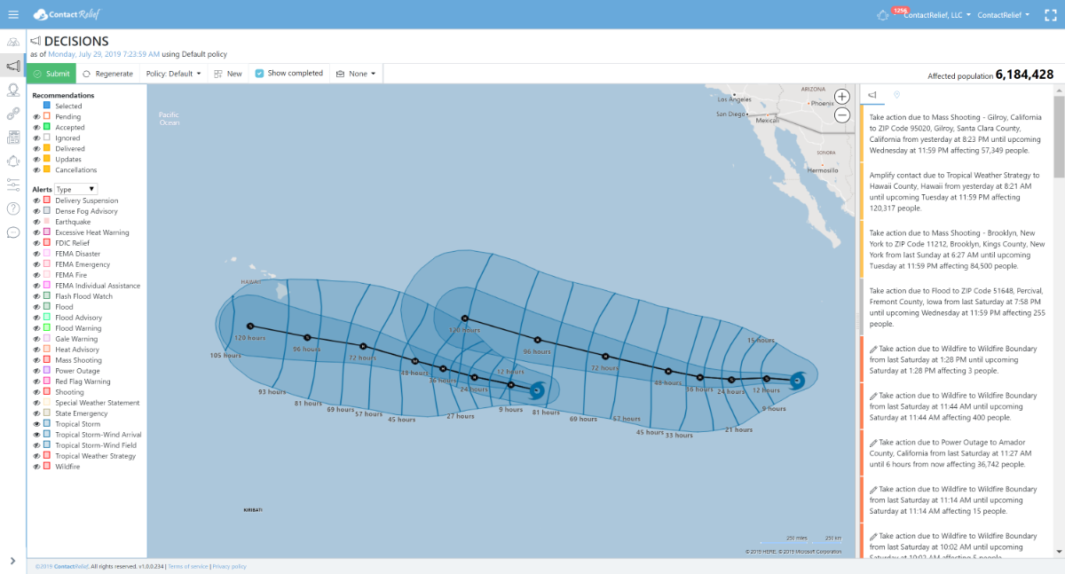
ContactRelief Recommendations
ContactRelief recommends amplification of contact through close of business Tuesday (2019-07-30) to the Big Island of Hawaii in advance of the approaching Tropical Storm Erick. Although some models are predicting a move further south away from Hawaii, the official 5-day forecast track puts the storm uncomfortably close to Hawaii on day 4 and after. As shown below, the ContactRelief Wind Arrival cone indicates a 50% chance of Tropical Force winds impacting at least the Big Island and possibly points further north. Tropical Storm Flossie follows behind Erick and is also expected to reach hurricane strength as early as Tuesday.
While we have seen other storms on this path pass south of Hawaii without cause for alarm, subscribers that want to protect their contact operations from the possibility of disruption due to Tropical Storm Erick should consider amplifying contact now in advance of the storm.
Protect your brand AND revenue when disaster strikes.
Try ContactRelief FREE for 30 days. Discover how we can help you reach up to 5x more customers in a disaster zone – while protecting your brand image.
Start free trial